A new educator's first foray into modern media

Category: Screen Capture

Wolves and Airships and Axes, oh Minecraft!

Today we had a team of experts from Colquitz Middle School come to UVic and teach us how to use Minecraft EDU, an educational application of a computer game that I haven’t really thought about since my friends got into it about ten years ago. We learned about the ways Minecraft can be used to promote teamwork, communication and collaboration, creativity, and survival skills in students and classes. The experts told us about projects they have done in Minecraft, including building competitions using Creative mode and ancient civilization simulations using Survival mode, and code machine-like creations using certain materials! Their teacher also showed us how to design a game and curate the students’ interactions. There are pre-built worlds and games for several different age groups, and in different core subjects, although if the teacher is well-versed at creating in Minecraft, building your own worlds is the best idea.

Then they let us play:

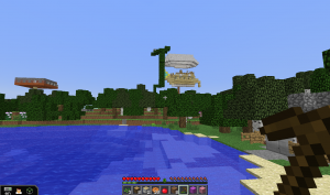
Some of my classmates with more experience built a ship in the sky!

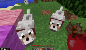
Little wolves were very friendly and followed us around – until it gets dark. Then they get deadly!

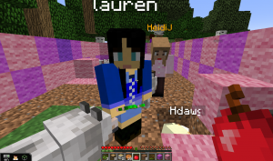
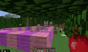
These players created a house out of pink and purple stone…then filled it with puppies!

I have to admit, I am not the kind of person who gets into video games. I didn’t find anybody to play with right away, and with no idea what I was doing, I spent a lot of my time ‘in game’ wandering around and watching other people create.

All the same, I was completely immersed in the world, and felt, as the Colquitz teacher put it, “as though the mouse was my new eyes”.  Despite my lack of engagement in the game, I really enjoyed watching other people play and get really involved in it. This tells me that Minecraft EDU would be a great way for me to let my students explore, play, and teach me more about how this immersive and completely customizable tool.

However, this is also a caution. In any class, there will be students who are as overwhelmed, inexperienced, or easily frustrated with this game as I was. Building (or using one of the pre-built) games with specific goals and making teamwork a priority would be necessary in this case, so that students are more motivated to work together and bring their peers up to speed. My feeling is that I need more experience with Minecraft before I can ever consider building it into my classes. If my buy-in is low, students will sense this. If my expertise is shaky, there is only so much patience my students can be expected to have in teaching me. It was interesting to watch my colleagues get immersed and really passionate about the game, and I can see many of them building Minecraft and other immersive games into their curricula. For me? I’ll stick to real dogs for now.

Teaching Climate Science with Windy

What is Windy?

Windy is an app (available free for Android and Apple users – with no ads!) developed by a Czech kite enthusiast as a way to visualize weather models. It’s also available in browser format, which I’d highly recommend using for demonstrations and screen captures. It’s an amazing and versatile app that could be used to learn about Earth’s weather systems, climate change, and the nature of predictive models. It’s used daily by sailors, surfers, governments, disaster-relief organizations, storm-watchers, and anybody who wants to know the weather. I use it to check forecasts before boating or doing field work near the water, and sometimes I just have it running in the background because it’s a beautiful interface and it’s fun to watch hurricanes and typhoons form and move before my very eyes!

Explanation of the most commonly-used parts of the Windy interface. Screen capture and labels by me.

Using the interface, you can toggle on/off a variety of layers including wind speed/direction (including particle motion animation), rain/snow accumulation, cloud cover, barometric pressure (with colour and/or isobars), humidity, tide level, and others. You can also toggle on/off the locations of airports, popular surfing spots, weather stations, ports and marinas, etc. You can search for locations, although I’ll caution that the fine-scale accuracy (accounting for the presence of islands, mountains, etc. within a city) is rather poor – it’s mostly used for wider-scale predictions. The user uses the same types of motions to zoom in and out or move around the map as is used in most mapping programs, including Google Maps, so it’s really intuitive. The units of measurement (precipitation, wind speed, etc.) are customizable, so you can set it to metric or imperial units if you wish. You can even change the altitude, so you ca have a look at how the pressure changes 2 km above us, or visualize the Gulfstream, or look at the ‘top’ end of a hurricane.

Using it in Class

I can think of a dozen ways to use Windy off the top of my head, but here are some ideas to get started:

  • Current events. As part of a unit on weather or climate change, get students to find a weather-related news story from somewhere in the world and use Windy to visualize it and show the class.
  • The fallibility of models. To help students understand that weather models are predictive but not deterministic, get them to check Windy each day from Monday to Thursday and write down what the app says the weather will be on Friday.  In fact, Windy allows you to switch between different models to compare them. The students will notice that the prediction changes each day, and that the prediction might not be completely correct when Friday rolls around. This helps them understand that any predictive model is only as good as the inputs, and that the results may not be what is predicted. Despite the pretty pictures, Windy is not showing what happens; it’s showing what is predicted to happen.
  • Place-based learning. Ask students to report about a particular place in Canada, and what the climate of that place is. They can use Windy to illustrate their reports.
  • Demonstrations of real-life phenomena. This is where screen-capture technology comes in. Rather than illustrating concepts like pressure differentials, Coriolis effect, front systems, and energy movement around the Earth, why not show students using a dynamic tool like Windy? Screen captures from Windy can ask students to play along on their phones, or just observe as the teacher demonstrates textbook concepts with real-time predictions of hurricane formation, El Nino, the Gulfstream, prevailing wind directions, and the effect of the ocean on coastal climate?

This app can be used in other contexts than science (art comes to mind, as well as geography). I highly encourage you to download this app and play with it. While this is not formally part of my EdTech inquiry on environmental apps for place-based learning, I’d like to highlight it here regardless. No pros and cons list for this app, because there are so few real cons!